
Twelve Peaks
Kosciuszko National Park

Australia’s highest peaks are all along the Main Range of Kosciuszko National Park. The Main Range Walk loops 24 kilometres from the ski resort of Charlotte Pass and can be done in a day. Instead, I spent three and a half days covering about 60 kilometres, lots of off-track walking and summiting Australia’s 12 highest peaks1.
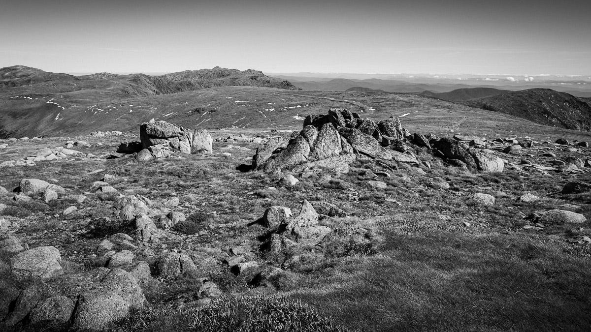
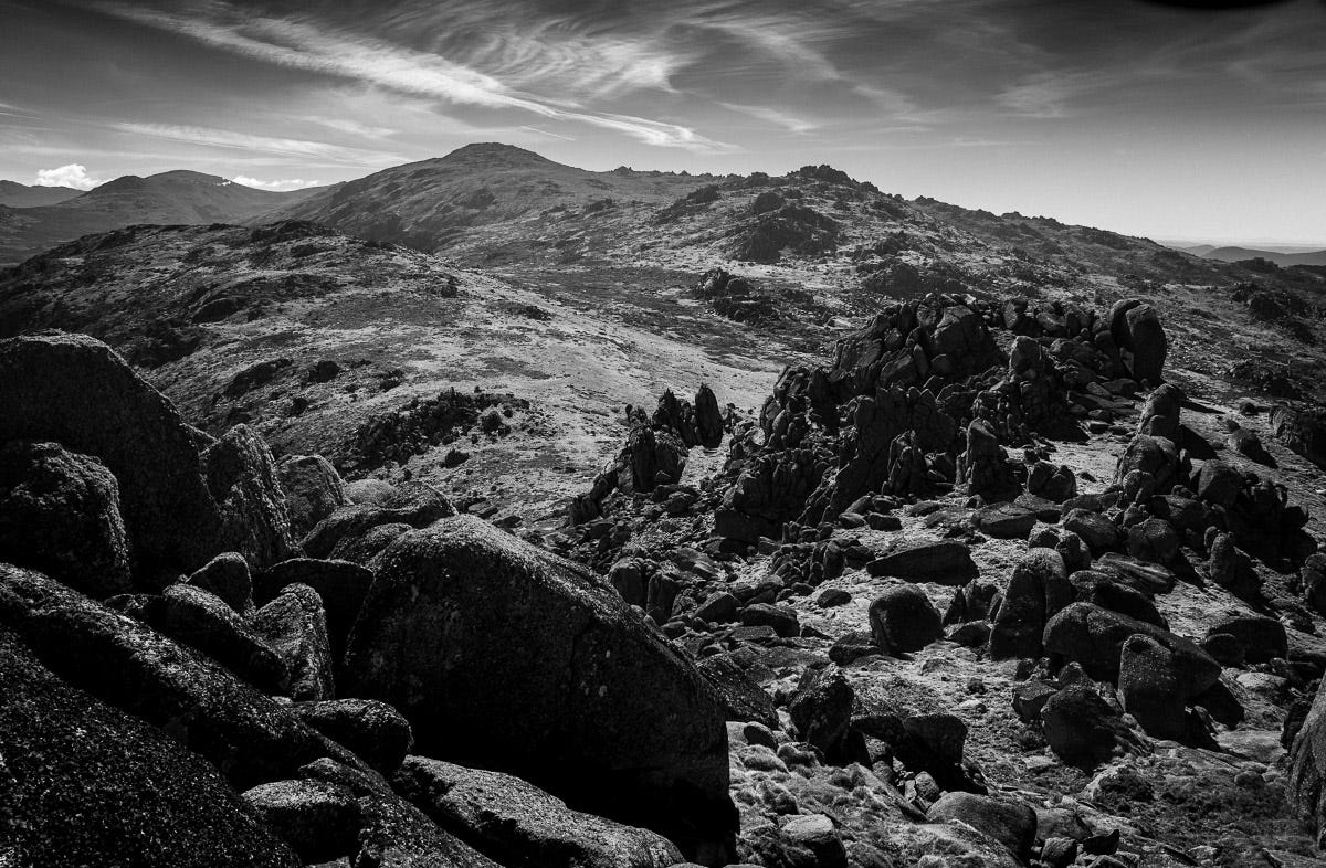
After 7 kilometres and a long sustained climb, the first peak, Mt Tywnam (2196m), was only a few hundred metres of open grassland from the track. Nothing more than a gentle rise afforded views to the south towards Mt Kosciuszko (above, far left) and north towards Mt Jagungal.
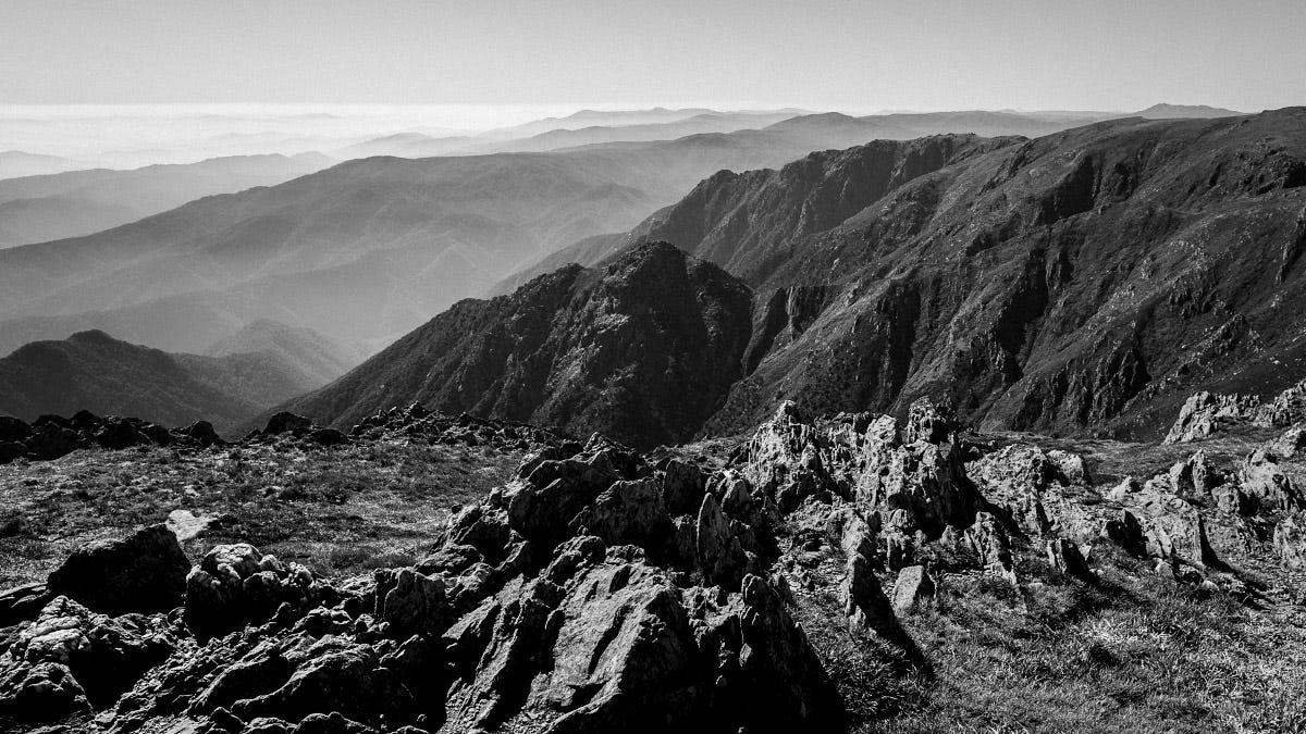
The second peak, Tenison Woods Knoll (2136m), was also off-track but out on a spur, each side dropping precipitously away. While the high plains are benign on a fine day, there is no avoiding the treachery of the steep sides. Famous are the stories of people disorientated and desperate to escape a blizzard, in their confusion entering the wrong gully, looking for escape and never returning from the steepness and the impassable vegetation.
After two more peaks, camp on the first night was at the headwaters of the Wilkinson’s Creek. The creek meandered through a lovely broad valley; a few other hikers widely dispersed. The air chilled rapidly as the sun was lost so it was hot food and early to bed.
The sunrise from the summit of Muellers Peak (2120m) had no gentle transition; the horizon’s shadow rapidly retreated as the harsh light glared across the rugged terrain.
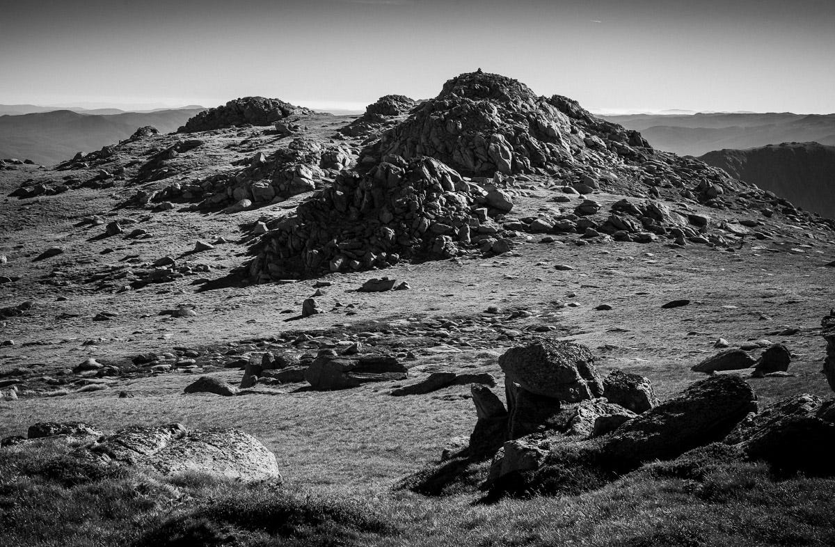
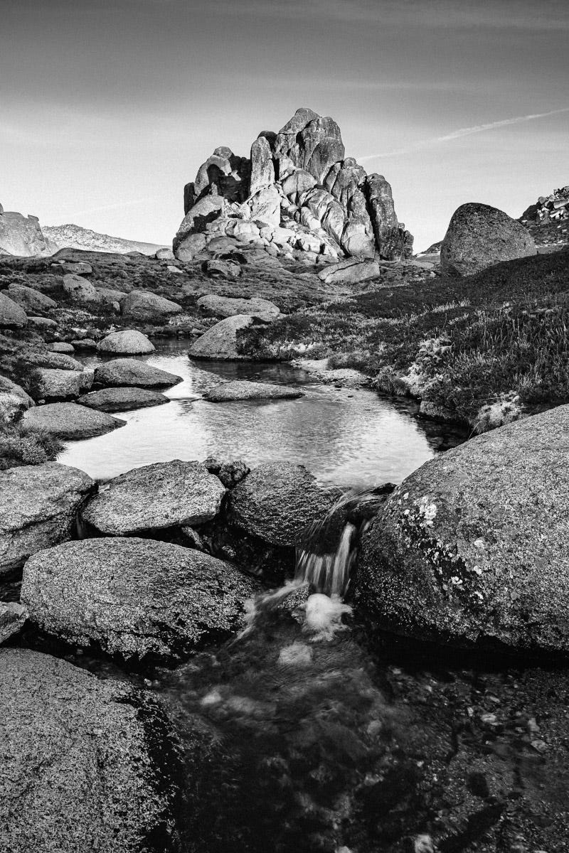
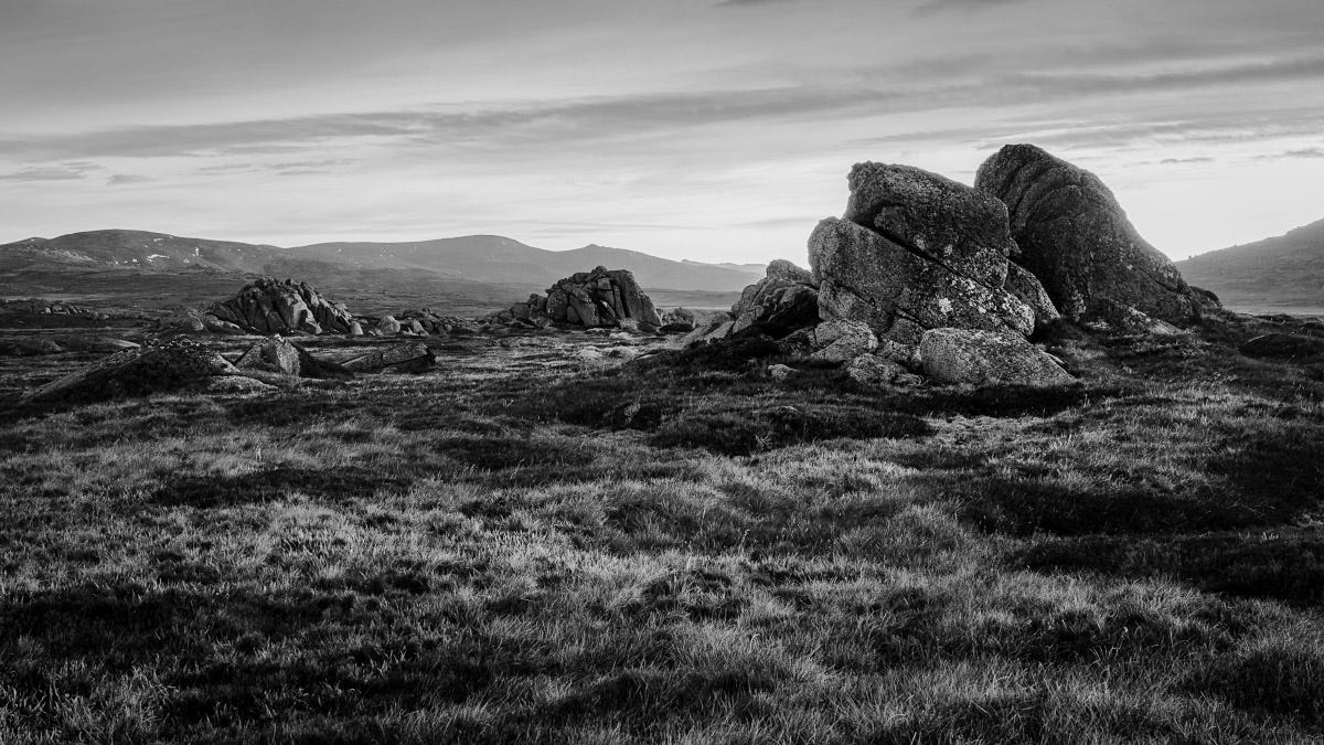
From here, a loop extends out to Alice Rawson Peak (below), then Mt Townsend, Abbott Peak and Mount Du Faur and back to camp. There is no trail and the air was cold (the puddles were frozen) but the walking was easy on a blue sky day. Off the Main Range Walk, the country feels remote, the senses more alive. The only navigation required was weaving through the granite outcrops and finding the best way to the summits. Mt Townsend (2209m, Australia’s second highest) required some rock scrambling and took a couple of backtracks to find the way up. It felt like a mountain summit.
With camp packed up, it was onwards to Australia’s highest mountain. The walk to the summit of Mt Kosciuszko (2208m) is an unnecessarily long spiral despoiling the slopes with a highly engineered road. I am uninspired, my camera packed away.
The broad, rounded summit on this beautiful day was filled with people. At midday, people of all kinds were enjoying their picnics. Like a scene from Where’s Wally, there was even a couple getting married. I made my way past the long queue waiting to stand on the summit cairn and take a selfie, just touching it was enough for me. I had a snack and was on my way as quickly as possible.
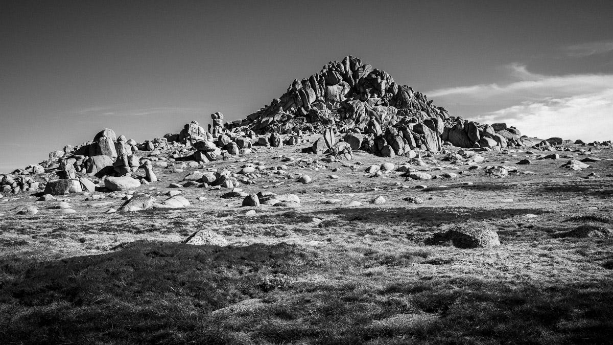
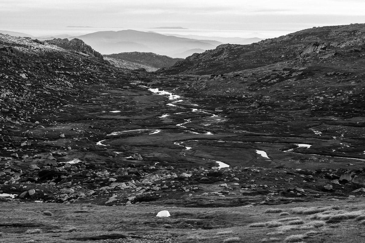
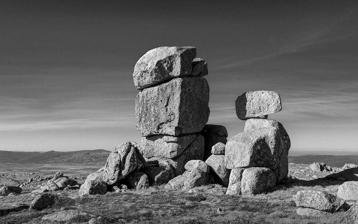
Some of the Main Range Walk is raised, metal boardwalk. Perhaps it slightly vibrates, I find my legs ache more than they should. So I am pleased to leave the marked trail and head steeply up to a saddle below Mt Ramshead North (above). The other side reveals another broad valley filled with granite tors. There is a lake I recognise from Instagram. I spend too long looking for just the right tent site but am soon exploring the rugged valley with my camera, in the zone.
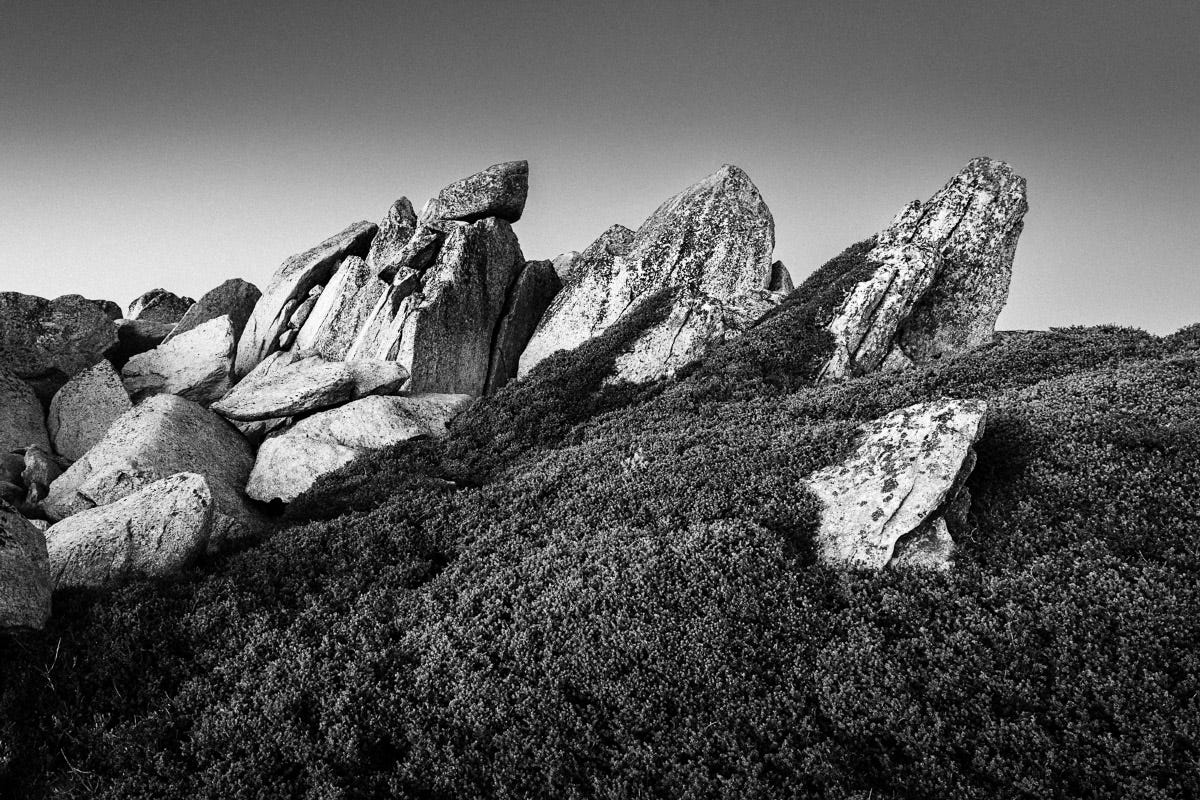
After 2 hours exploring the valley in dawn light, I am again climbing a mountain. It’s a long steady ascent to the top of Mt Ramshead but the views are worth it, particularly of Mt Kosciuszko - it’s rounded bulk ever present on this walk. The loop is quite long heading out a spur to Mt Ramshead South. This peak was a jumble of outcrops that required careful navigation, a natural maze. The final summit was an exposed scramble.
From the tent site, I had less distance and more time to explore the tors and scramble up the twelfth summit. Camp on day 3 was at the headwaters of the mighty Snowy River amongst a series of granite outcrops, no-one for miles.
The last day started with a spectacular sunrise and some frantic running around to find foregrounds and align outcrops. Then it was a final pack up for the short walk back to the car (7 km) and the long (7 hour) drive home.
The 12 highest peaks as walked:
Mount Twynam: 2,195m
Tenison Woods Knoll: 2,134m
Carruthers Peak: 2,145m
Mount Northcote: 2,131m
Muellers Peak: 2,129m
Alice Rawson Peak: 2,160m
Mount Townsend: 2,209m
Abbott Peak: 2,145m
Mt Du Faur: 2,159m
Mount Kosciuszko: 2,228m
Unnamed peak on Etheridge Ridge: 2,180m
Rams Head: 2,190m
Rams Head North: 2,177m
Excellent. Goes to show how poor my Aussie geography is. I had to look it up. Some lovely images, thank you!
Wonderful photos, James. I have ascended most of those peaks, some in Winter snow. It is fabulous country in any season... You capture it perfectly.
Best Wishes - Dave :)