
Trails through history
Understanding shifting baselines

I am fascinated with our relationship with Nature, and as a landscape photographer, how I see the landscape is of great importance. “How do we say hello to here?”, asks Pádraig Ó Tuama, “There are many ways, but they all centre on reality.”1
But what is reality? In the first newsletter of this mini-series, I sought to see the magnificent Mountain Ash of Victoria’s Central Highlands from a scientific perspective. I then asked in my last newsletter what it means to know and be known by the forest.
This newsletter continues this theme. Today, I look at a landscape that is subtly but materially impacted by history. There are the remnants of the physical scars of this history in the landscape, but the more important impacts are only apparent when you understand the ecology of the forest and take the time to look and ask.
Part 1
During my first trip exploring a river flowing off the Baw Baw plateau, I came across an old logging trail that roughly followed the river upstream. I spent a very enjoyable morning walking up the trail, occasionally climbing down to the river where I thought there might be a photograph to be made.
In some places, the trail was completely lost with thick bush and fallen timber. But in many places, earthworks cut through spurs and earthen bridges had been built across streams, all with the intention of smoothing out the terrain to drag timber out by horse. Although there was no track as such, these physical works made for much easier walking.
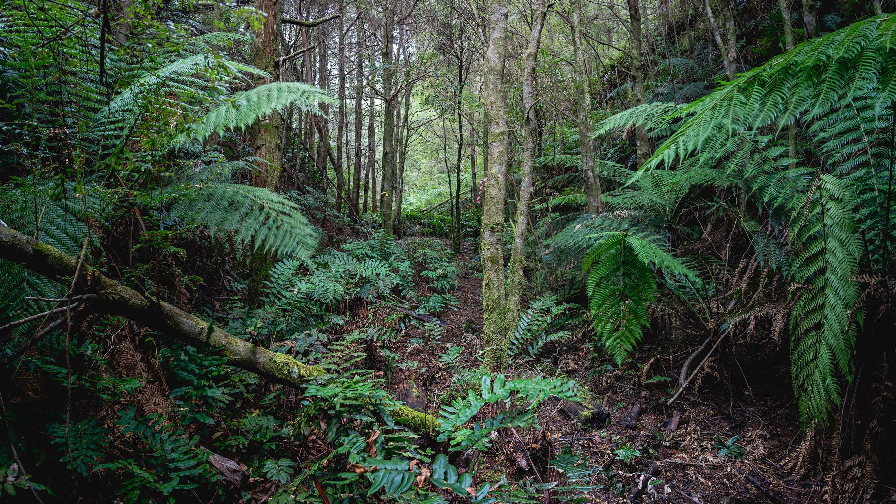
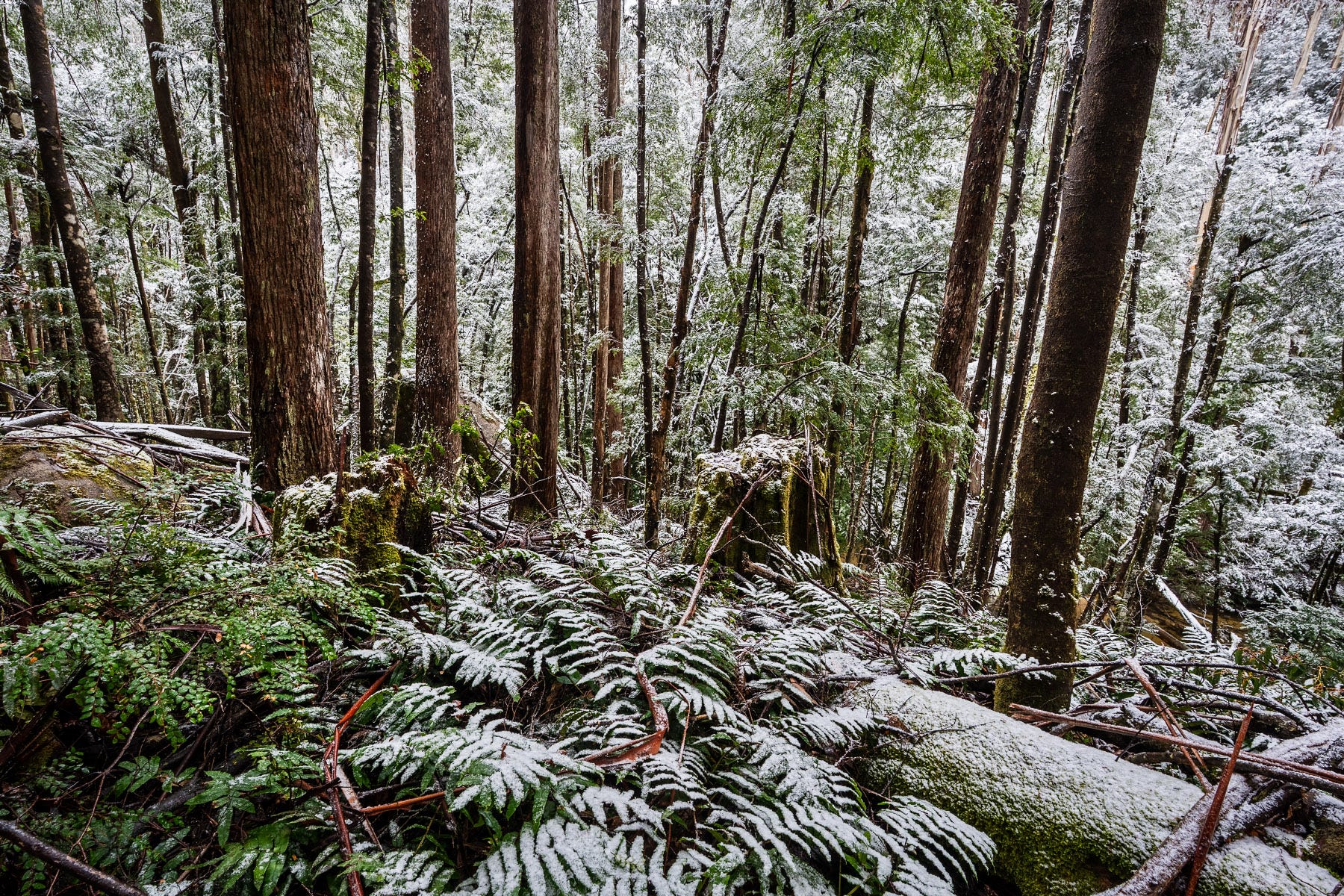
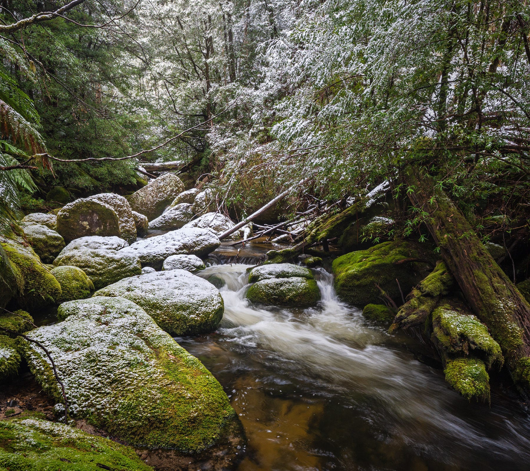
Climbing up and down the steep sides of the valley to the river was hard work however, and the going slow as I sought elusive compositions amongst the thick bush, fallen timber and chaotic boulders. The light was not great for photography – the two images below are probably the best of the lot. The first is taken from an elevated position on the hillside, and then the second of the same scene from the riverbed itself.
This was not the most productive day of photography, but I love engaging with the terrain, coming to understand the changes in vegetation and topography. As I was exploring, I was trying to understand the forest I was seeing. Pre-trip research had not indicated any previous logging2 but I could see a few cut stumps of very large Mountain Ash.
Knowing the Kirchubels Tramway and Historic Area was marked on the map a little further downstream3, I committed to understand more about the history of the area and its impact on the landscape.
When I got home, I did some research on the history of the area and who built the track.4 It appears that the Kirchubels mill had operated from 1940 through to 1957 (although its heyday was the 1940s) to salvage Mountain Ash killed in the 1939 Black Friday fires. The tramway eventually extended some 1.5 kilometres upstream from the mill and included 15 crib log bridges, the longest spanning 73 metres. Logging at this time with winch and tramway usually involved 10 men and 3 horses. This would have been dangerous, tough work.
An outlet tramway was also built following the 1939 fires to support a number of mills in the area and ran for 5.63 kilometres to the township of Tanjil Bren, itself established to support the timber industry. The Kirchubels tramway met the outlet tramway at Tramway Falls (now I know where it got its name) about two thirds up its length. The top of the outlet tramway was roughly where I started my walk.
Part 2
Armed with this new knowledge I returned to explore further upstream. This time I was at the trailhead under very different circumstances. There was no pleasant weather – the sky was heavy with an expectation of snow – and instead of a vague understanding of the terrain, I knew exactly where I was headed.
Traversing an area off-track is much easier when you’ve been there before. Rather than 40 minutes of wandering, it took about 10 minutes to head down an unmarked but well-formed walking track to a fallen tree that almost spanned the 15 metres or so of river. Although it was moss covered, and needed a careful dismount, I successfully got to the other side without getting wet and was on the old logging trail.
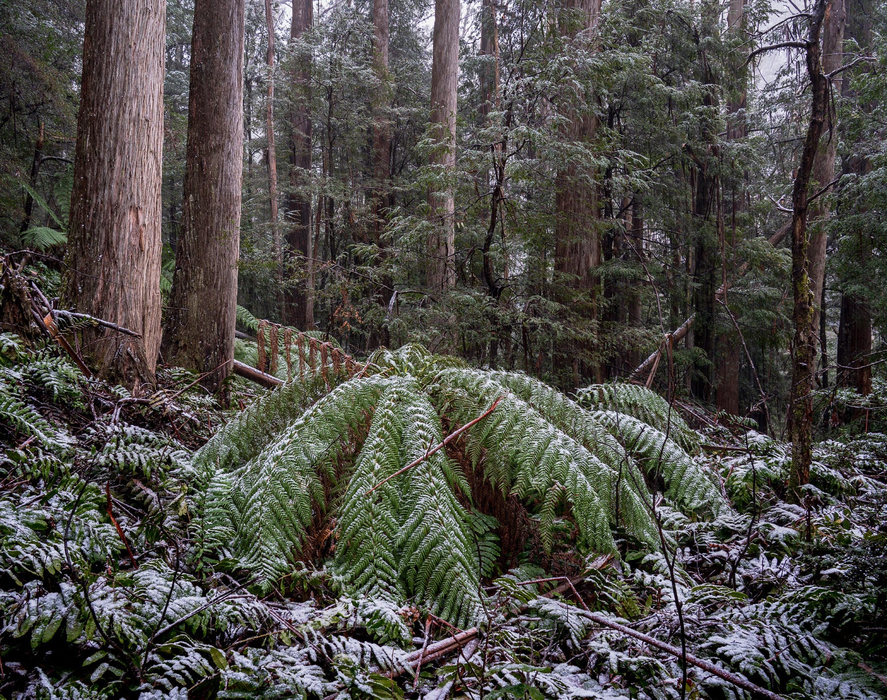
As the snow started to fall, initially as big wet blobs, I was engulfed in the dark green of wet vegetation. I made good progress up the trail, moving around and over the familiar trees and ferns I had previously explored. Snow adds contrast and complexity to already chaotic scenes, but I couldn’t resist stopping to take the image of a tree fern with a dusting of snow.
There were increasingly intense squalls of snow passing through as I made my way upstream, although deep in the valley there was little wind. After only an hour or so (it took me 3 hours last time), I reached sections of the river unknown to me. At this point, I started my zigzagging up and down the side of the valley looking for compositions.
With my new found knowledge of the logging history of the area, I could now see things that I hadn’t seen before.
The logging track followed the line between the Wet Forest full of valuable Mountain Ash above and the temperate rainforest below. Perhaps the 1939 fires did not burn the rainforest all the way down to the river? (I have seen this above Marysville after the 2009 Black Saturday fires). Certainly, it was placed to make extracting the timber much easier.
I knew these forests had been devastated by fire in 1939, some 86 years ago. With the subsequent logging, any surviving mountain ash (generally the biggest and oldest) would have been harvested in these salvage operations. So where you might get a variety of stands of different ages across a landscape, nearly all the Mountain Ash were roughly the same age, just at the age when rapid growth was tapering off and they begin to senesce and create hollows for wildlife.
Perhaps most surprisingly, while on the previous trip I spotted the occasional stump of an old tree, now I was seeing the rotting, moss covered stumps everywhere. You only see what you are looking for. These stumps are often 3-4 times the diameter of the existing trees and would have been from trees 300-400 years old.
The image below shows the terrain. The valley drops steeply down to the river, which can just be seen in the lower right, and needs to be carefully negotiated to get down to the river to find a composition. Can you see the two Mountain Ash stumps?
Exploring the snow covered forest was a wonderful and rare experience. The going, as you can see from the image above, was tough but to see moss covered boulders covered in snow made it worthwhile. The photography on the other hand was challenging.
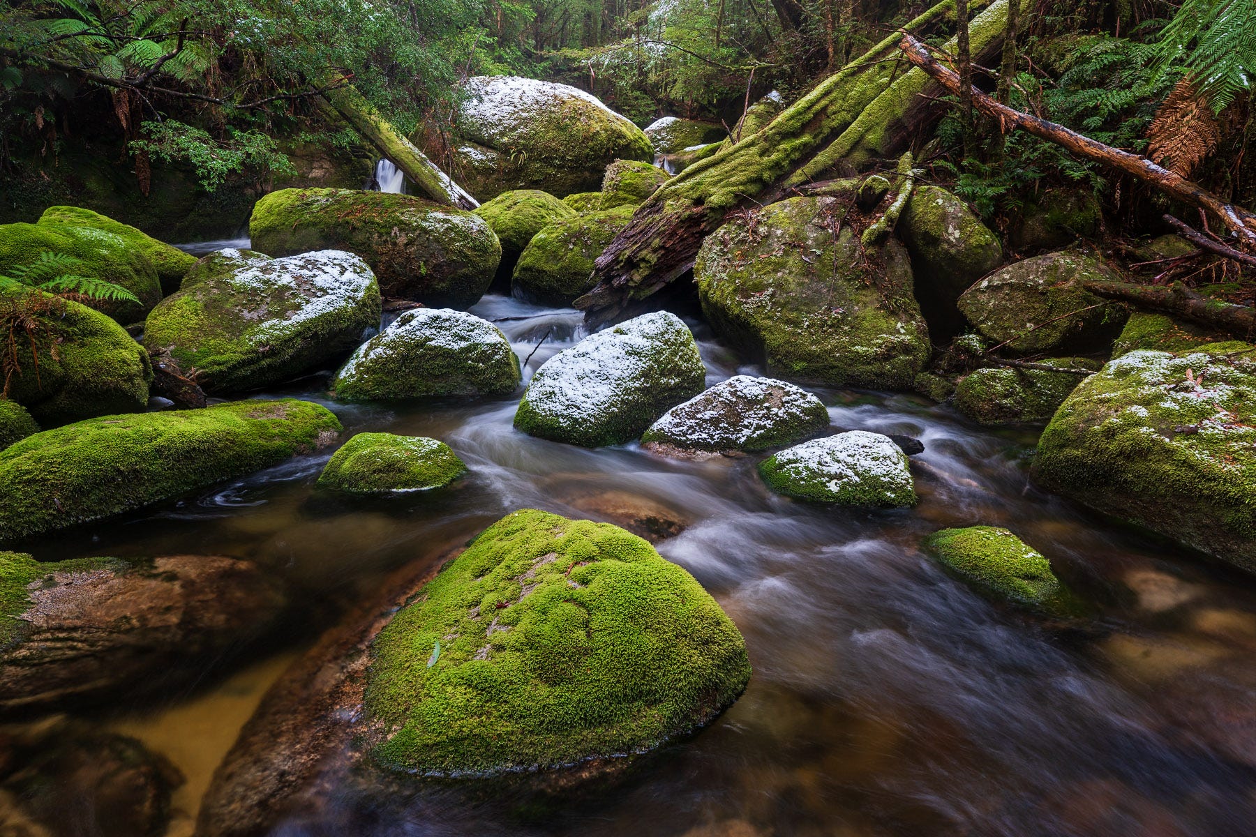
Typical of snowy landscapes, contrast was extreme when the light was bright, or dull when it wasn’t. There was little colour and not enough tonal variation for black and white. I wanted to capture this special moment that rarely happens in Australia. Below is an example - the image documents the scene but the composition is chaotic and there are few lines or light to draw the eye through the image.
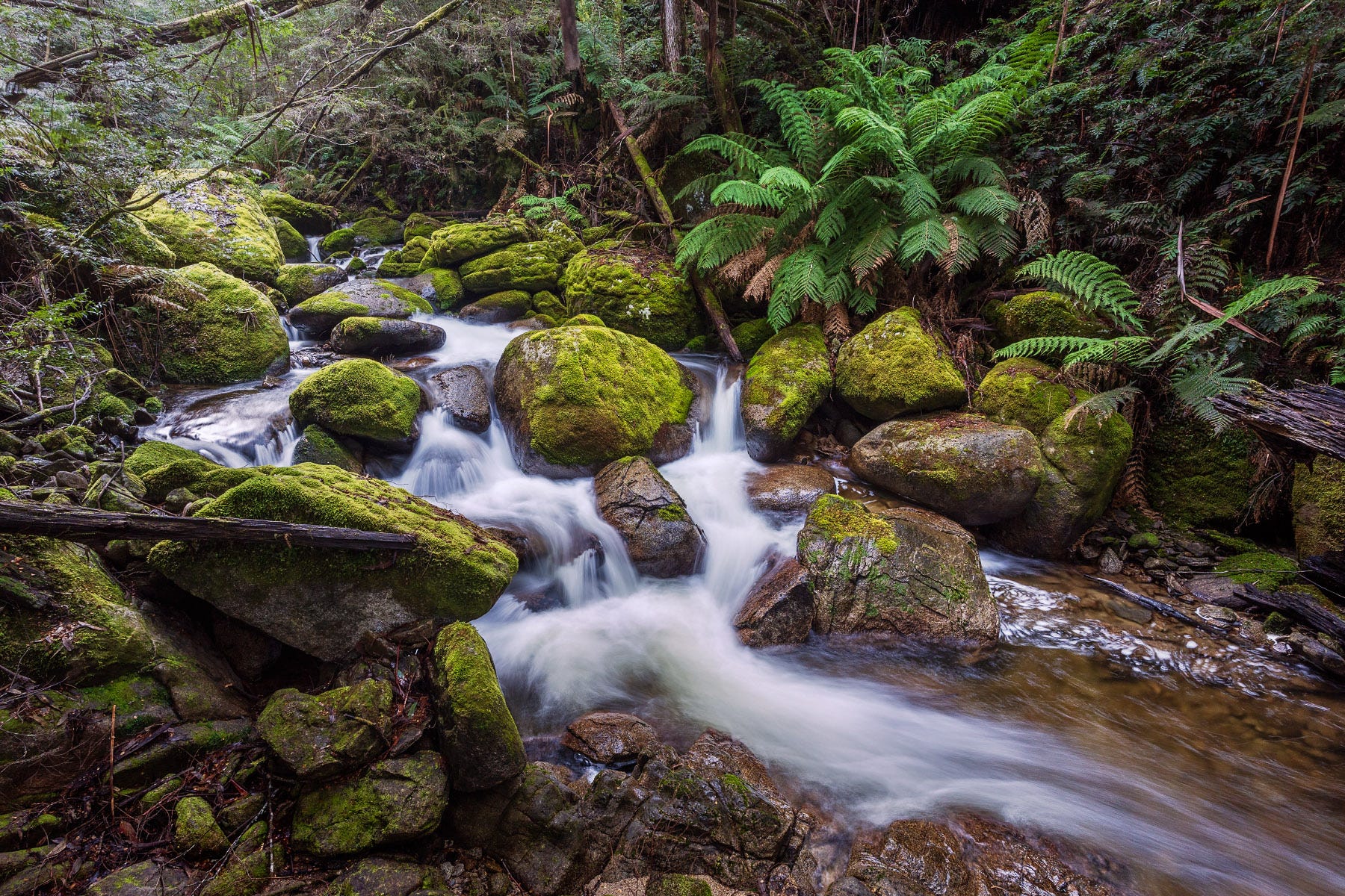
After a few hours I headed back downstream, somewhat frustrated at not finding the compositions I was hoping for. Although I was getting tired, I decided to climb down to a beautiful pool that I found on the first trip – with still an hour to walk, one last detour before I headed back to the car.
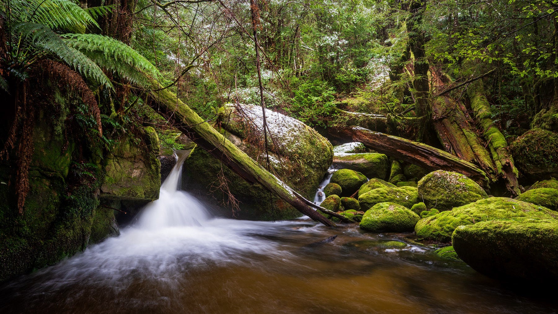
Finally, I found what I was looking for. Not so much snow that all colour is lost but enough to intrigue. I particularly love that the snow-covered rocks form a line, creating a strong mid-ground separating the boulder in the foreground and the jumble of boulders in the background.
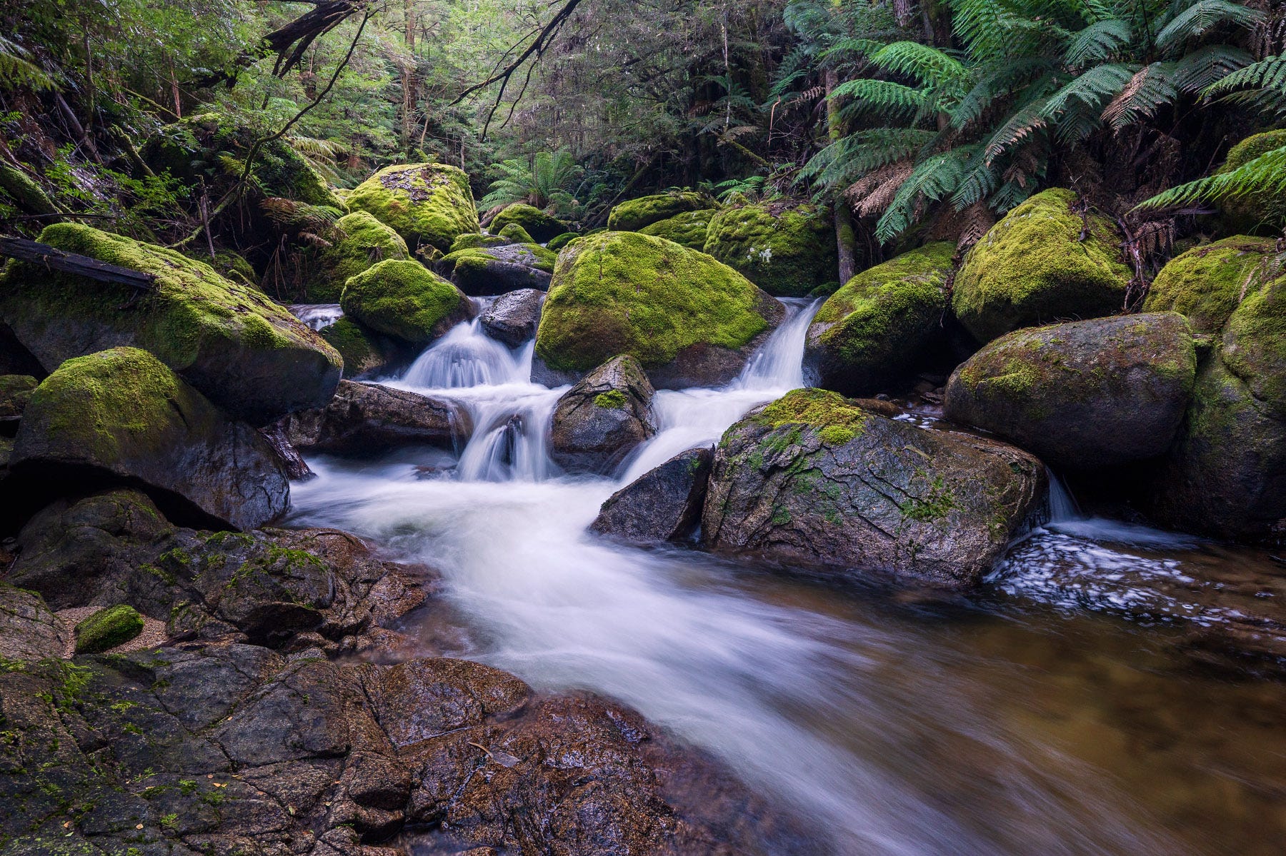
With new found enthusiasm, I rock hopped back up to the pool I had previously tried to photograph. A pool has been formed by a huge boulder where a small tributary tumbles down on one side and the river spills over a small waterfall on the other. The first time, the light wasn’t great (poor light is the landscape photographer’s perennial excuse!) and I was too enamoured by the whole scene – which was amazing but did not make for a strong image. I had been disappointed by what I had come home with.
This time I focussed on the waterfall, forcing myself to ignore the beautiful little creek I was standing in. This is a far stronger image; one I am happy with.
As I made my way home, I reflected on how knowledge of the area’s history can change how I had experienced and understood this landscape. The shifting baseline effect, where gradual environmental changes are unseen as what is normal shifts over time, means that we don’t have a reliable basis to assess change and the impact of humankind on the landscape. History is important.
Postscript
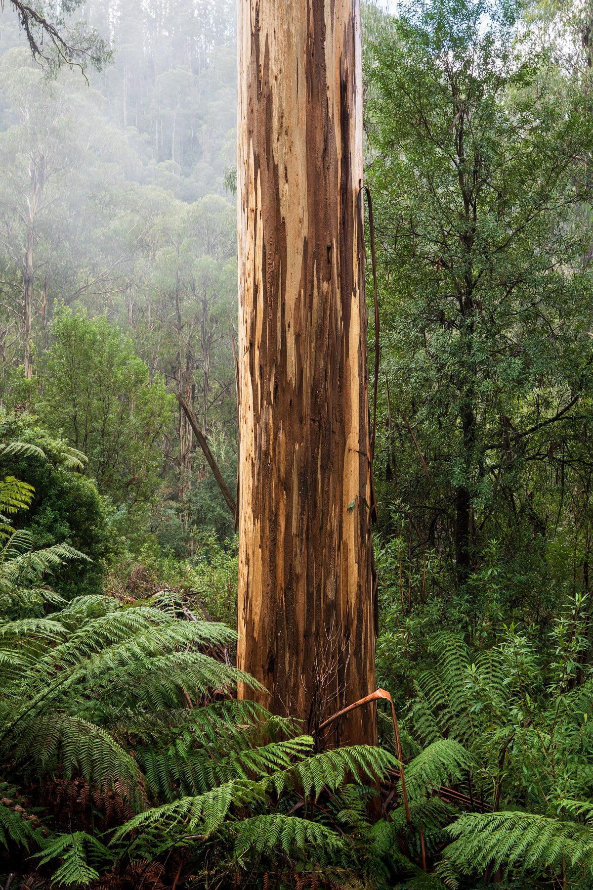
Hungry and tired, I was driving towards when Tanjil Bren when I met the slightest patch of low cloud. Of course I could not resist stopping to have a look. Here is my final image, back where this mini-series5 started, with the magnificent Mountain Ash.
Tuama, Padraig O. 2015. In the Shelter: Finding a Home in the World (p. 24). Kindle version.
I use MapshareVic (www.mapshare.vic.gov.au) which has useful map layers including past logging coupes, although the data seems to only go back to the 1980s.
The old mill site is rarely visited and hard to get to. I had never been there. From my car, it would require a couple of kilometres of walking and a dangerous crossing of a derelict (and closed) bridge above Tramway Falls or, from the other direction, a long drive on unsealed roads and several kilometres of walking along management tracks.
Particular thanks to The Light Railway Research Society of Australia, April 1992, Light Railways Number 116.


Gorgeous images as usual!
BEAUTIFUL PHOTOS!