
Lines on Maps
The map is not the territory

There is a river that flows directly out of the alpine grasslands of the Baw Baw plateau. It drops rapidly some 600 metres over 5 or 6 kilometres until it hits the first man-made structure, a dirt road. I have explored lower sections from the road, but I have long wanted to explore the upper reaches. It is wild, inaccessible country.
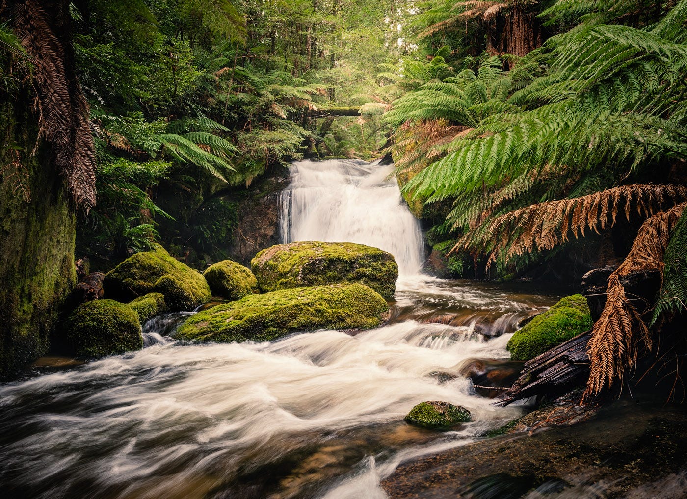
I have planned the approach. Up an old management track, through a coupe that was logged about 25 years ago, then into older growth that has not been logged for at least 80 years, if ever. From there, I would traverse around a spur and drop down into the temperate rainforest of the river valley.
How did I know all this? Maps.
The management track is on Google Maps. There are detailed topographical maps available online – I pay to download them to my phone. There are specialist datasets on government websites that can be mapped showing land use zones – Special Protection Zones, General Management Zones and Special Management Zones defining what can and can’t be done. Datasets showing past logging coupes, Ecological Vegetation Classes, Habitat Value and so much more.
Blank spaces on maps have always drawn explorers and conquerors, planners and developers. Each map defines a way of seeing the world, but they are not reality. The map is not the territory; it is an abstraction. Maps are beautiful things, but they hide as much as they reveal.
The approach goes to plan. About 40 minutes to walk 3 kilometres and gain 300 vertical metres up the management track. Another 40 minutes to bush bash about 250 metres through the dense undergrowth of the old logging coupe. And then about an hour (including a stop or two for photographs) through relatively open forest.
Already I had discovered much that was not on the maps. Massive boulders sitting proudly in the forest, covered in moss. Changes in vegetation where water would flow after rain. The beauty of a small patch of tree ferns amongst the Mountain Ash. The steepness of the river valley sides requiring some careful traversing.
But that is for a future newsletter. As I explored this valley, I thought about how we want to define and name places, to paint territory in a colour of colonisation, to exert a sense of control over the wilderness. Maps are beautiful things, but they can’t tell you what it is like to be there.
Lines on Maps
We name and label places – it is a power we grant ourselves
          Borders define what we are, and what we are not
          Labels reflect our view of the world

A blank space on the map – a useless waste
          To be filled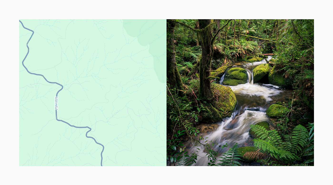
More information – but no more answers
To be simplified and codified 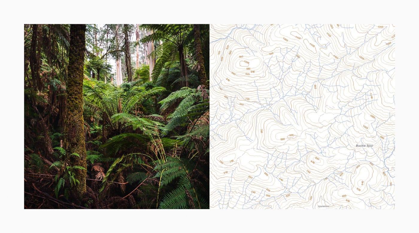
Parcels of land as part of a grand plan
          To be utilised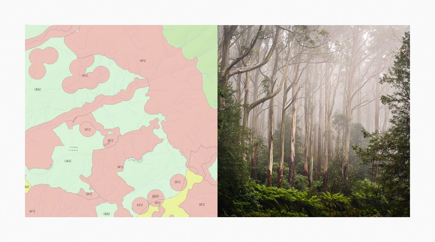
The scars of extraction
          To be discarded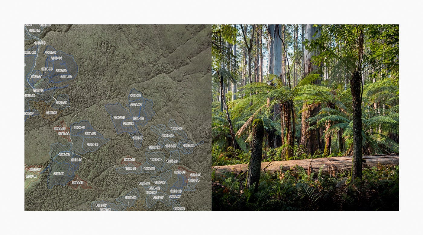
Nature categorised – the vulnerable identified
          To be protected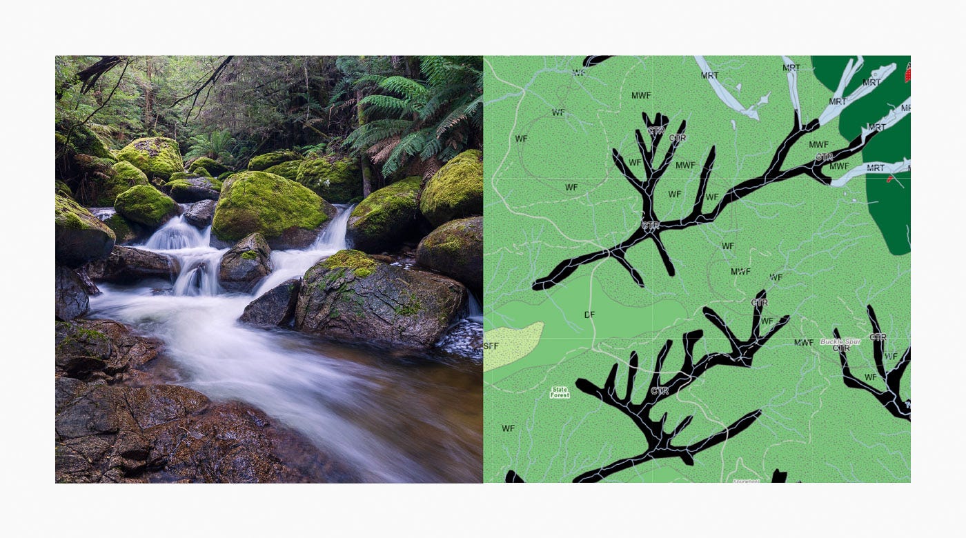
A place to find myself
          To be explored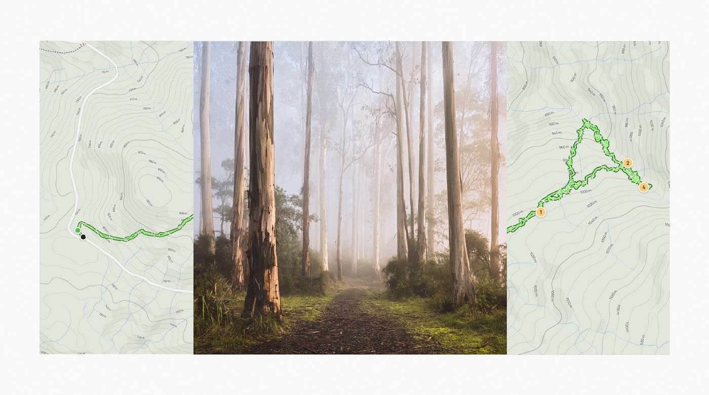
A great post James and some lovely images - the last one is sublime.
I love maps and the idea of combining sections of them with images is a really interesting one. I also really enjoyed the words you used with the photo / map combinations. It would make a lovely small project.
I read a book recently called Tender maps - travels in search of the emotions of place by Alice Maddicott . It talks about how we draw personal maps in our minds of places we have visited and how we build layers of meaning, experience and feeling for each one. I thought this was an interesting concept for a photography project especially if it could be combined with more traditional maps.
Thanks for sharing your maps and images - it has really inspired me.
Depends on the type of map :-) My own goal has been capturing “immersive spatiality” (I just came up with that, ha) which you could also call spatial experience. Basically montaging photographs/views together so they become map-like. Or maybe it’s the inverse - “breaking up” maps so they’re about the experiences within as much as the detached/controlling view from above. So there are possibilities between maps and photographs, but I’d say it’s actually redefining what a map can be….