


Exploring the Acheron River
Spending a day on new terrain

Hi, I am a landscape and nature photographer based in Melbourne, Australia and enjoy using my camera to explore our remaining wild places and connect with nature.
This post may be too long for email - if that is the case, please click the button at the top right of the email.
Part 1
There are many choices in making a map. As maps are only coarse representations of the real world, what is included depends on what the map maker wants to say about the terrain and how they perceive the map will be used.
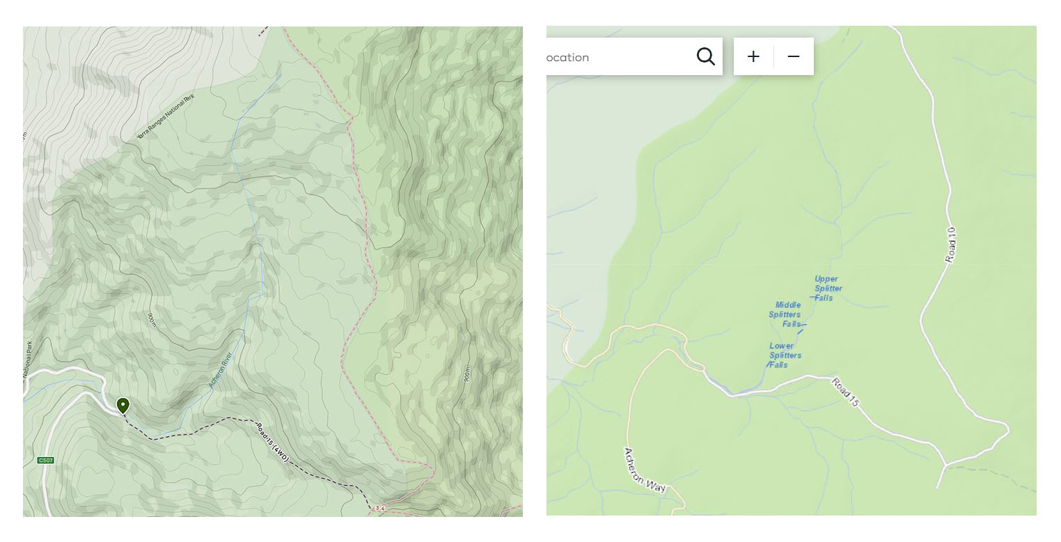
These choices are particularly stark when trying to understand the terrain well away from man-made tracks or infrastructure. Maps often vary in the information they provide, and multiple maps need to be consulted to gain a comprehensive topographical representation. For example, the All Trails map (above left) I often use for navigation does not show small tributaries and even larger rivers are an unrepresentative series of straight lines to approximate its path.
It was on the online Forest Fire Management map (above right, designed to show road closures) that I spotted three waterfalls on the upper reaches of the Acheron River, just below Mount Ritchie – the Lower, Middle and Upper Splitter Falls. I did some searching online but could not find images of these Splitter Falls on social media (unlike the Splitter Falls in the Grampians or the Splitter Falls in the Otways).
I had driven over the Acheron River where it crosses the Acheron Way many times. But in my memory, it was the same as any of a hundred such intersections. Beyond these topographical representations and cursory glimpses, I had no idea of the terrain. I had never paid much attention to understand its reality, let alone photograph it.
Part 2
My first day of exploration took the obvious approach. Park where the Acheron River meets the Acheron Way and walk up Road 15 (a management track closed to private vehicles) half a kilometre or so before heading off-track and following the creek upstream. Walking upstream has the advantage of making it easier to see compositions facing upstream, but the going is harder.

This trip is not the topic for today. Although it is only about 1.5 kilometres on the map as the crow flies, I actually covered almost 10 kilometres over 4 and a half hours to reach the base of a third set of falls (below, although I suspected they were not the actual Upper Falls). I was beginning to get a sense of the terrain, the nature of the vegetation and the creek, and had spotted some likely compositions to return to in better conditions.
I decided to climb to the top of these falls to take a look and make a decision whether to continue or head back down. The steepness of the valley required a wide loop back and up to safely navigate the waterfall. I ended up about 20 vertical metres above the top of the Falls. Standing on a very steep and sketchy viewpoint, I could look down into a thick mess of fallen timber and bush as the creek disappeared further upstream.
From this viewpoint, the river looked both impenetrable and irresistible. Who knows what scenes this forest may contain? I decided to return another day and undertake a longer walk to explore the very upper reaches.
Part 3
My next approach was to use the management tracks to get as close to the headwaters of the Acheron River as I could and then make my way downstream to where I had first entered the bush in my previous walk. Again, the day was sunny and expected to be hot (around 35 degrees C).
Waypoint 1 – 6.3 km, 1 hr 40 min, 8.32 am
I have been walking for 1 hour 40 minutes climbing Mount Ritchie via Road 15 to a saddle between Mount Ritchie and Smith Hill, and then up Road 10 which follows a spur to Mount Ritchie. Despite the steep sections as I gained about 450 metres, the early morning sun filtering through the trees made for very enjoyable walking along well-maintained four-wheel drive tracks.
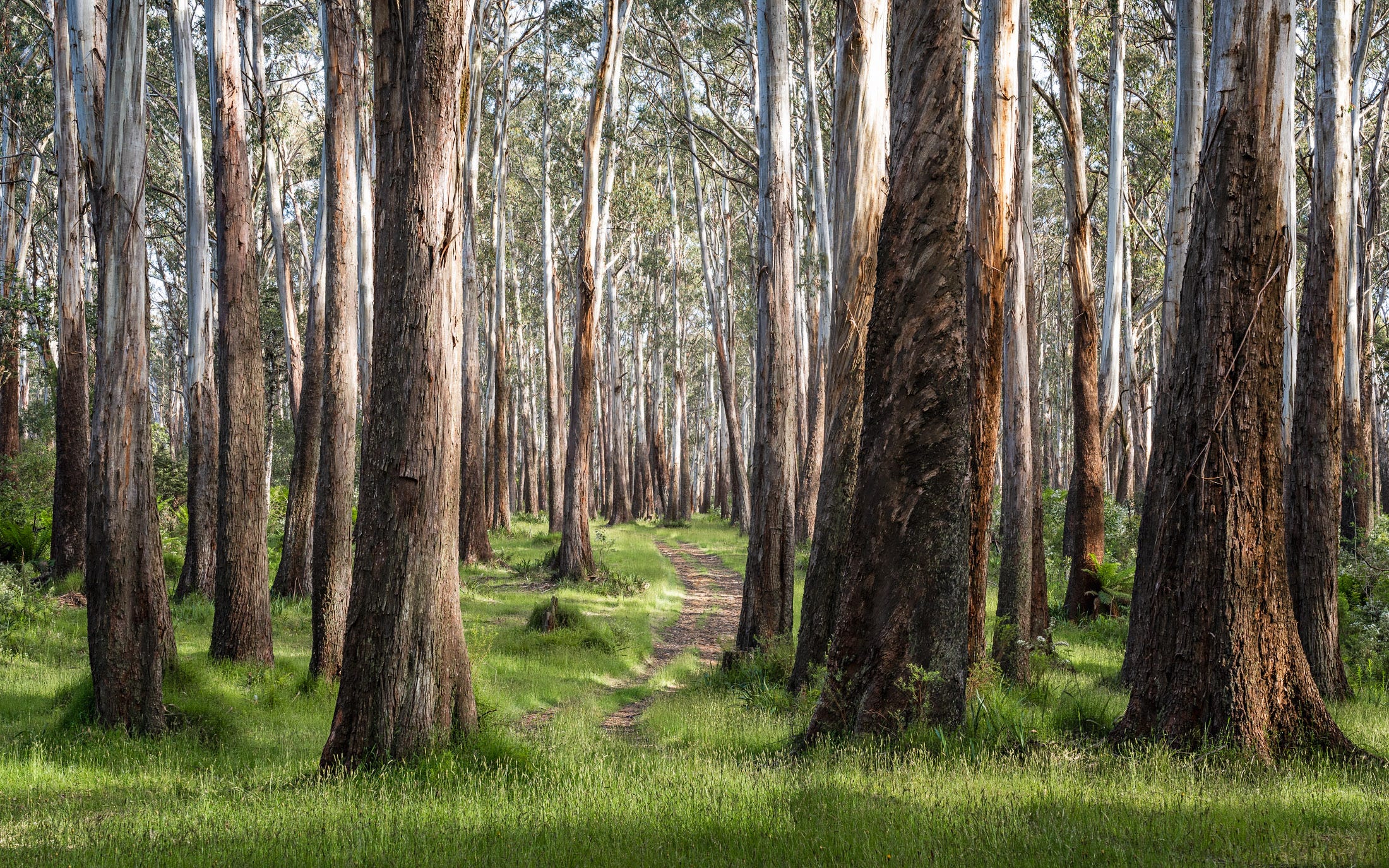
Eventually the track levelled out to a beautiful section (below) along a ridgeline with the headwaters of the Acheron River somewhere to the west. This section had a good 5-10 metre clearing on each side but the big eucalypts remained. Many of these old trees had their base burnt out creating large, blackened cavities that you could easily stand in. Presumably a fire will eventually take them down but I was pleased that they are left for now.
I reached a point just before the track does a little dog leg away to the east and heads uphill steeply. There seemed to be no point climbing to gain more elevation, so I decided this was the place to head off-track and traverse across to meet the top of the Acheron River.
Waypoint 2 – 7.6 km, 35 min, 9.07 am
I have reached the Acheron River. At this point the valley is wide and shallow, and the river is no more than soggy soil and a few streams of water not yet forced together by the terrain.
Taking a welcome drink on a convenient fallen tree trunk, I take the time to watch and listen to the birds coming down to investigate this stranger in their forest, enjoying the gentle burble of flowing water in the background.
I am pleased with my navigation skills - it seems I was not the only one to decide this was the place to traverse around the hill. Almost immediately upon leaving Road 10, I found a very old and overgrown track which I suspect had been used by timber harvesters back in the day to haul their felled trees out. Although the track provided a level and direct route to the water course, the going was still slow with a lot of fallen timber and scrubby bush to push through. And looking downstream, it appears the going will get slower and harder.
Waypoint 3 – 9.4 km, 1 hr 30 min, 10.40 am
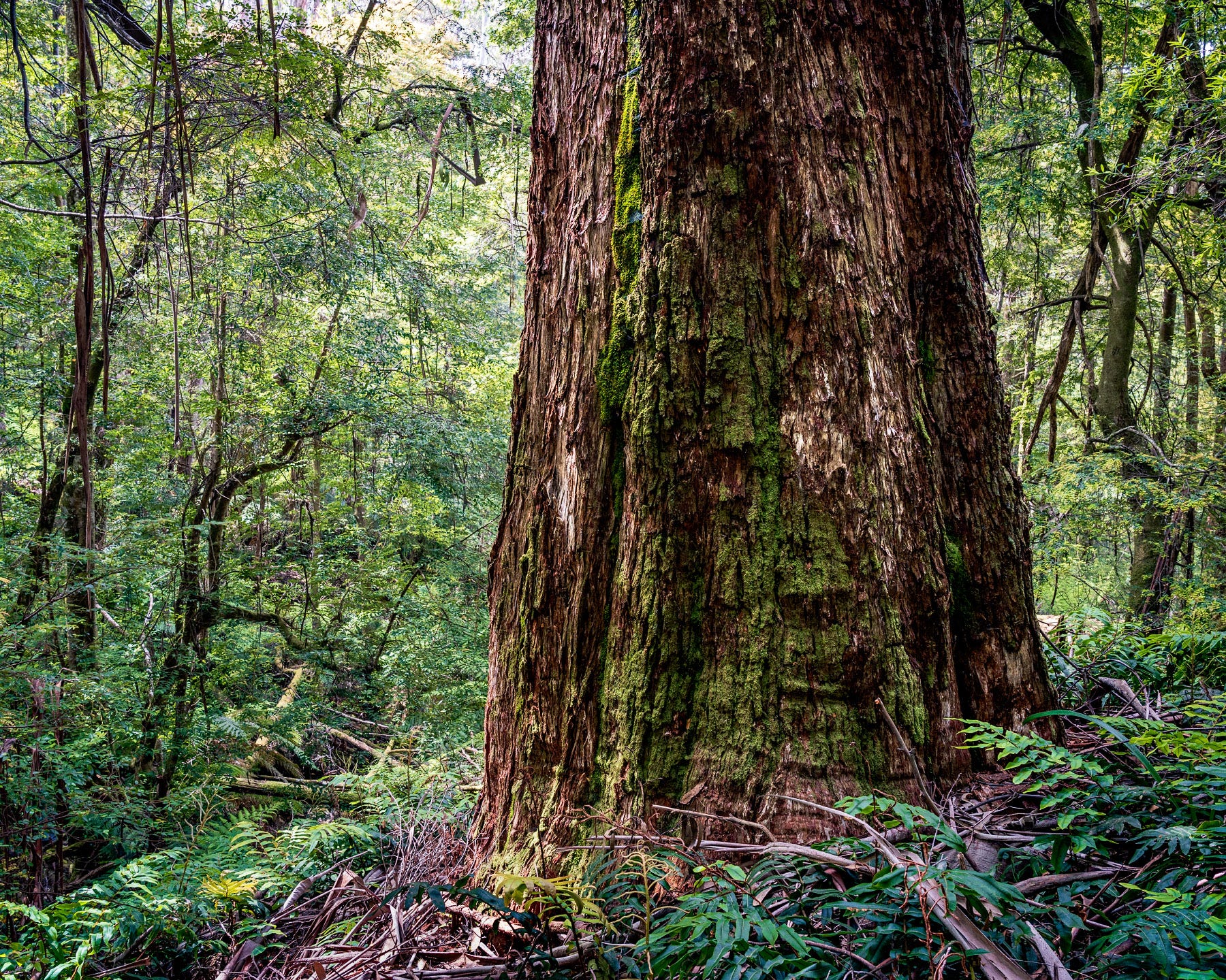
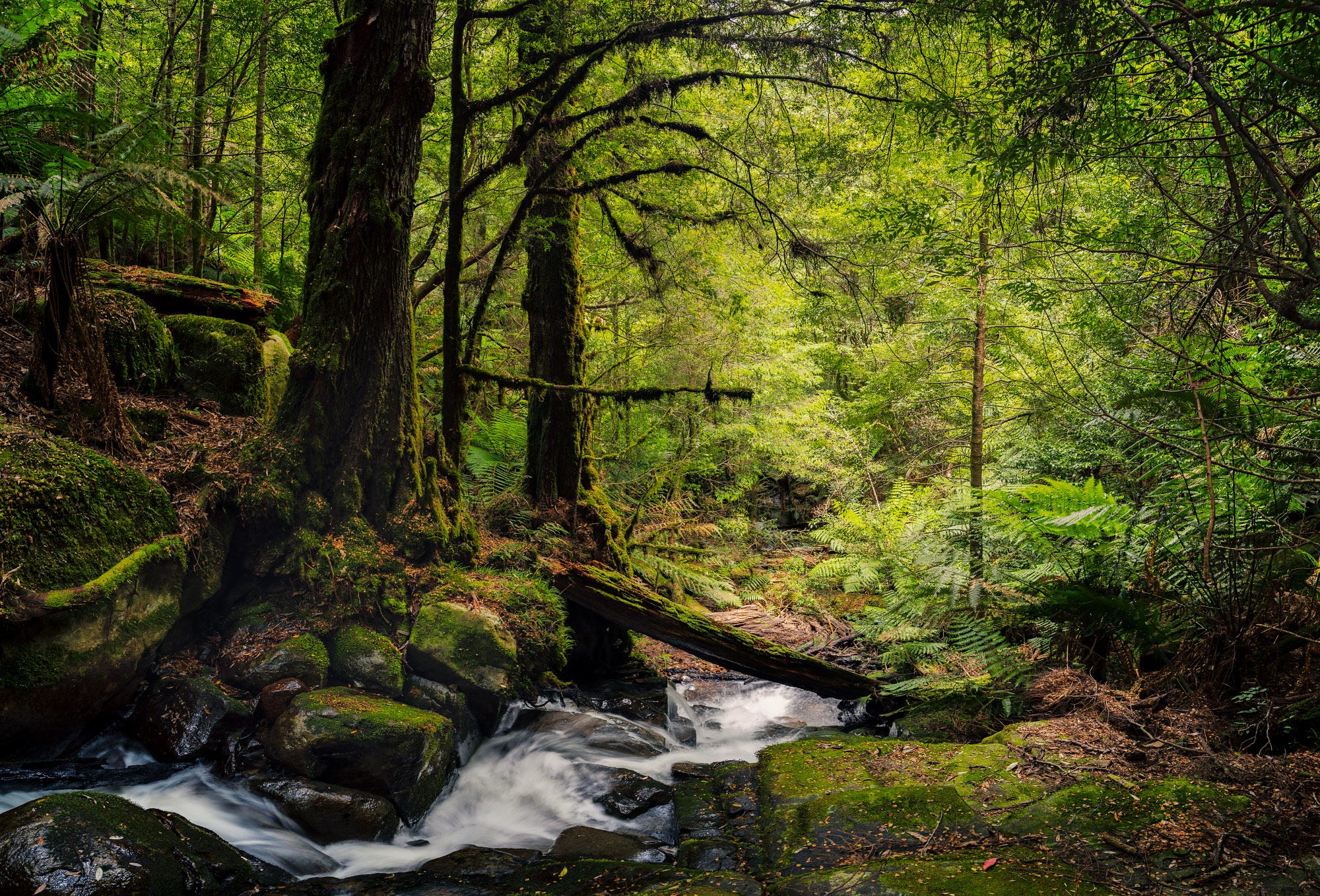
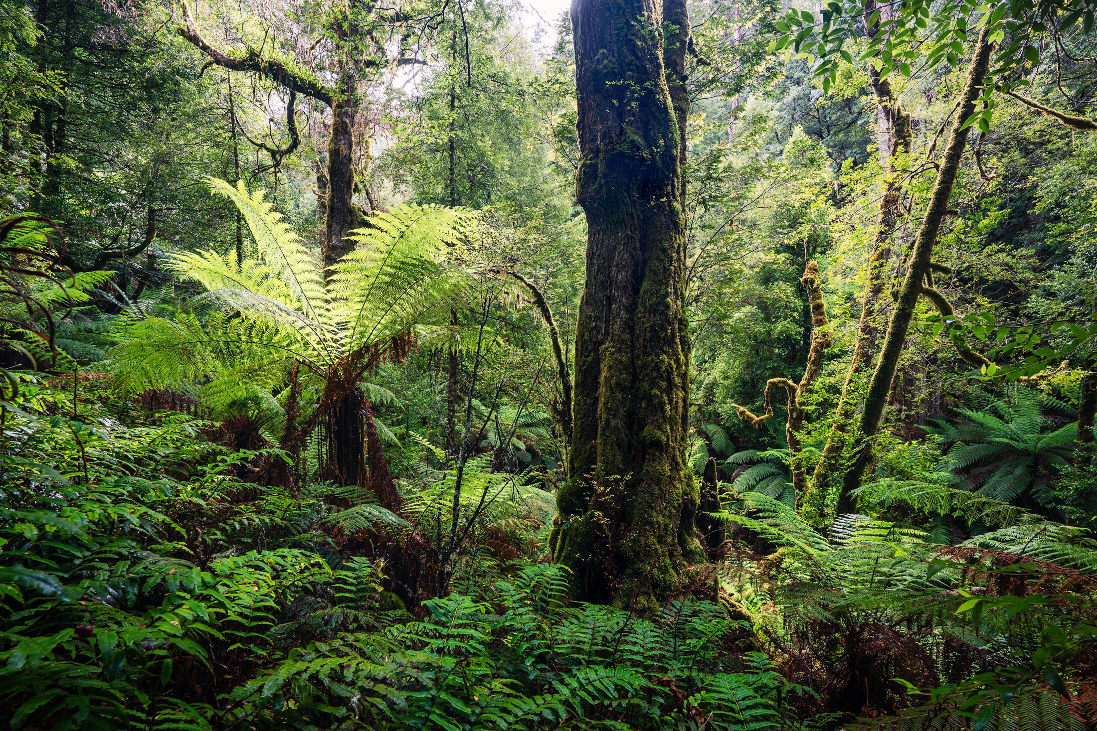
I have made my way downstream about 2 kilometres over the past hour and a half. The stream has become more distinct with a few sections of water flowing over rocks. There have been sections of tree ferns but mostly it is dry forest with an understory of thick scrub or ferns below tall eucalypts. I stopped at one impressive tree to take the photo below, capturing the still morning light softly filtering through the vegetation.
My route has varied from walking in the creek bed itself or higher up the side of the valley as I seek to avoid the thickest scrub and fallen trees. With the river not offering much photographically, the scenes are nicer up higher.
I have paused here to have a drink (the day is heating up) and examine a tree stump with the marks where the loggers had put their plank to allow them to stand as they cut the tree. Difficult and dangerous work. I take a photo of the tree stump – it is a point of focus amongst the vast mix of tree trunks and greenery, although I know the image is more documentary than artistic.
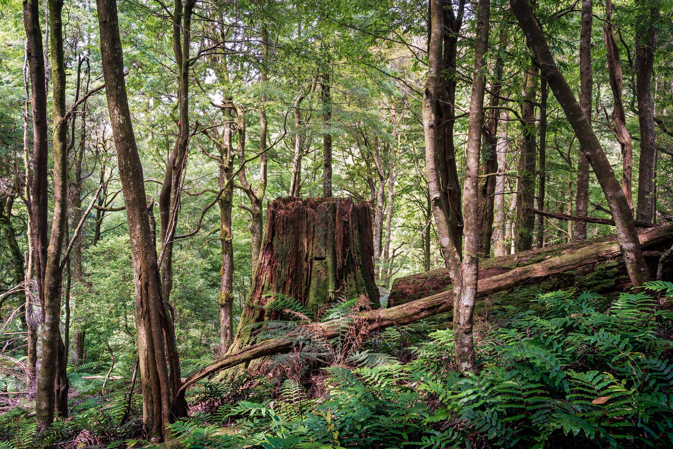
There is another massive old tree nearby, perched on the very edge of a steep section dropping down to the river – perhaps its location saved it from the loggers? From here it is clear that the terrain drops away steeply. As shown on the maps, the contours tighten and the valley becomes much deeper.
While some high-level cloud has formed, I am still hoping for more cloud cover to both cool the day and reduce the harshness of the shadows. We will see.
Waypoint 4 – 12.1 km, 1 hr 12 min, midday
As expected, the terrain has become much steeper. I wouldn’t call the valley a ravine or a gorge – the sides of the valley are rich, deep soil rather than rock – but at places they are far too steep to safely climb. As a result, I am forced to stay mostly beside or in the creek. The water level is low, so walking in the creek is a good option although there is no chance of dry feet.
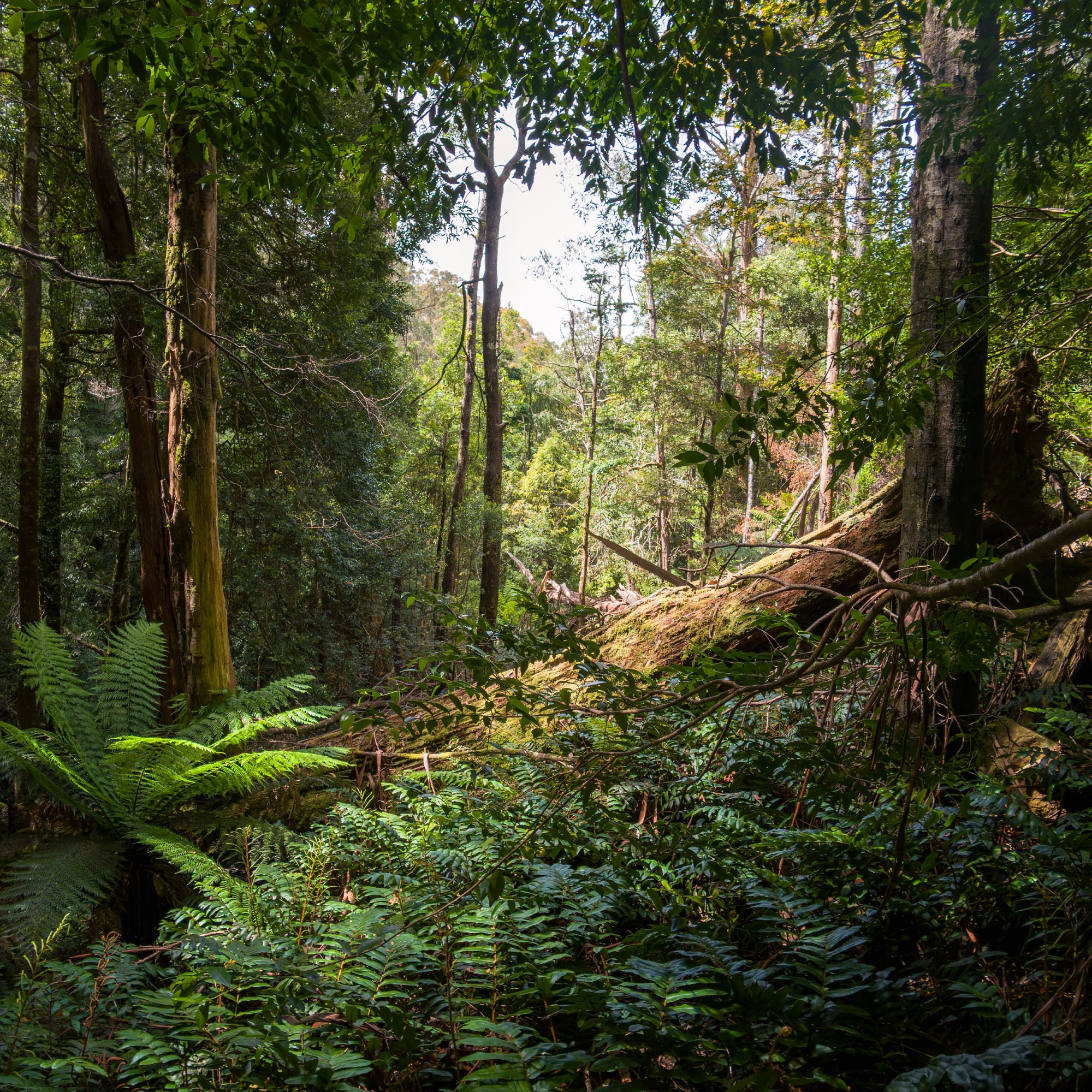
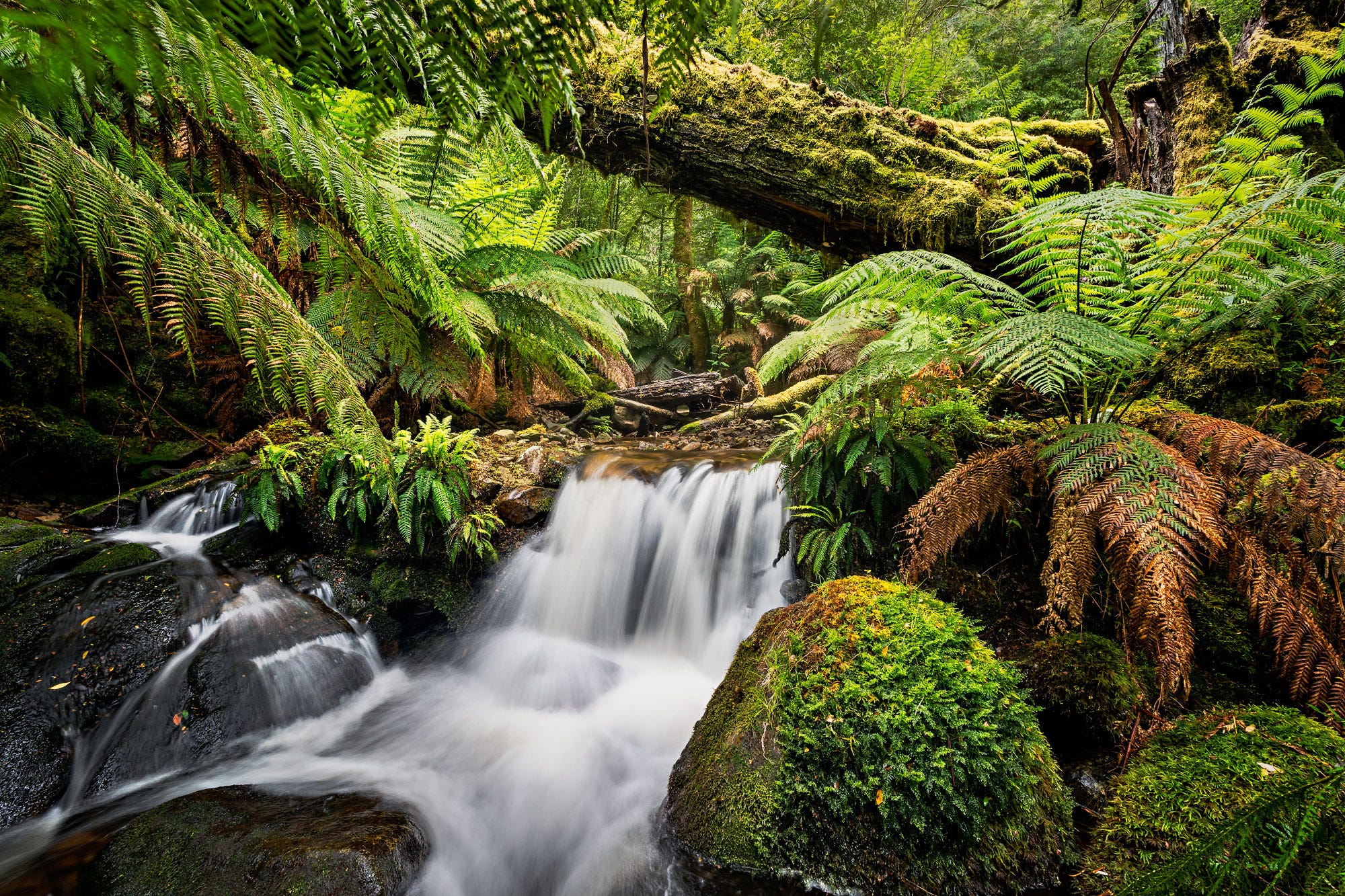
The vegetation around the creek is now beautiful cool temperate rainforest which makes for easier walking. The tree ferns and dense canopy means there is relatively little ground cover to negotiate. However, the going is slow due to the occasional rocky drop that needs careful navigation and the large number of fallen trees. Some of these trees have lost their footing on the steep terrain and can, with trunks over 1.5 metres in diameter and 60 plus metres long, demand significant detours up the side of the valley to get around. Occasionally, the pack comes off to allow me to go under rather than around.
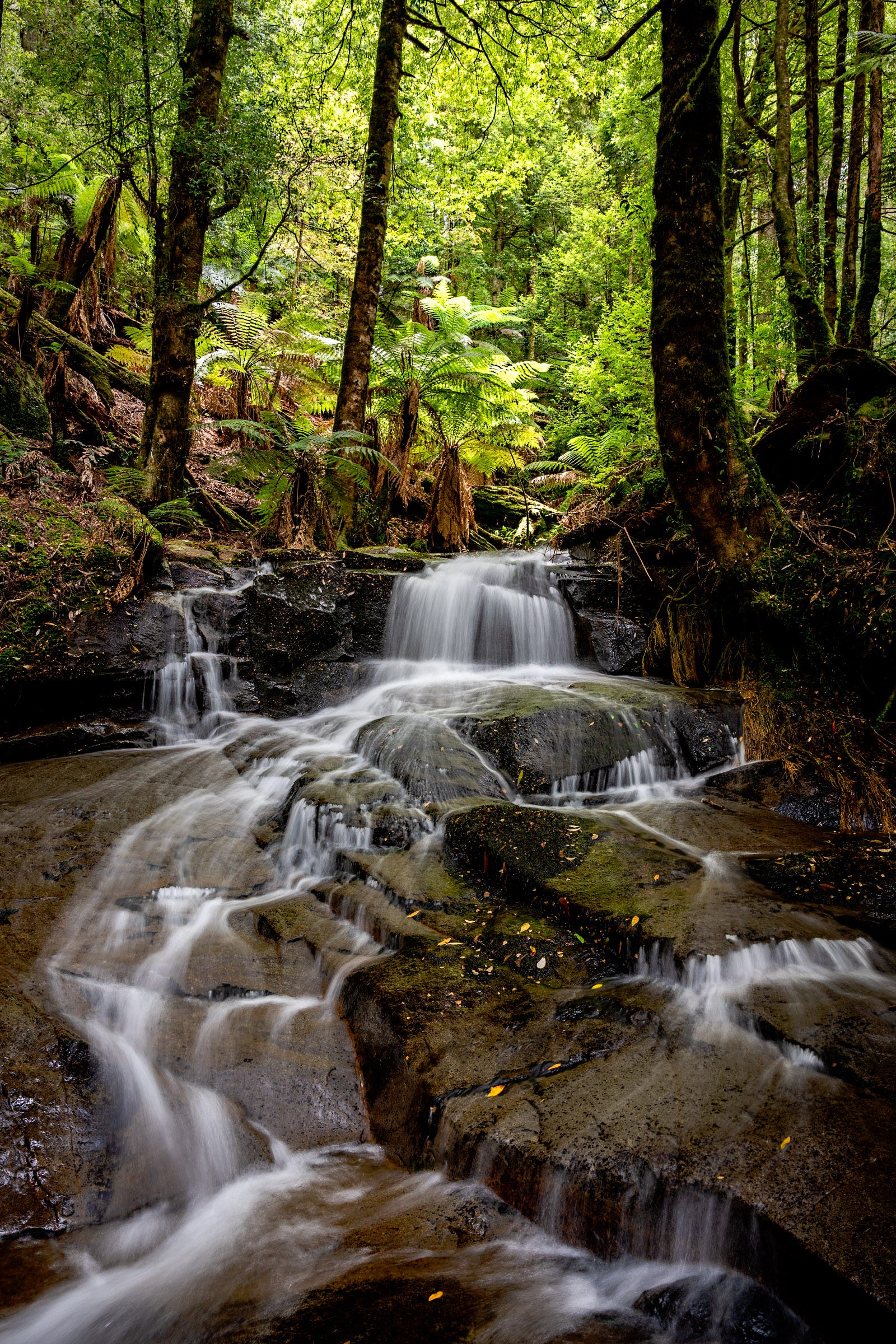
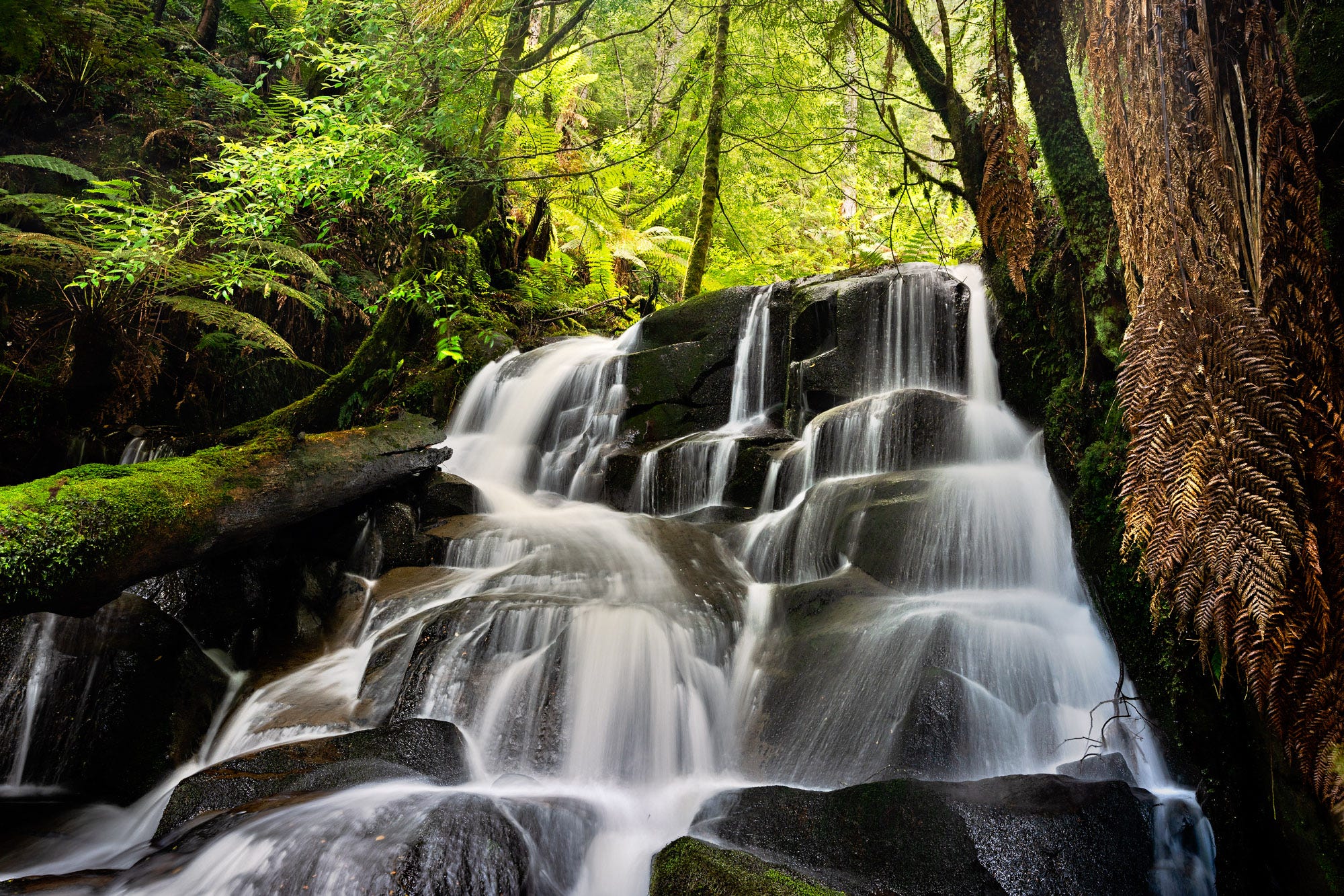
I stop at the base of a nice little waterfall (above) and have a muesli bar and a drink as I enjoy the view. While the low flow of water makes for delicate patterns in the long exposure images, I can’t help but wonder what this creek would be like with more water. Without a large catchment, I would need to get up here as a heavy rainfall event was ending. It would be a wet, hard approach but with heavy cloud and a touch of directional light, there would be some nice images to make.
After taking a few compositions, I need to keep moving. I don’t think I have reached Upper Splitter Falls yet so there is a way to go.
Waypoint 6 – 13.4 km, 37 min 12.30 pm
Below my last stop, a series of rocky outcrops and an increasing number of fallen trees forced me to climb out of the bottom of the valley. On all fours, I was able to zig-zag out and traverse along the side of the valley. With the river rapidly losing elevation, very quickly I kept finding myself some height above the river.
It was at this point that I spotted through the trees what must be Upper Splitter Falls. At a distance they looked quite impressive, but they were in full sunshine, so I marked them on my map and didn’t bother taking a closer look.
With a concerted effort to lose height (it always seems more natural to drift upwards when traversing across a slope), I found myself down at the river again. I was pretty confident that I was in the area I had seen at the top of my first trip. Having walked into this complex valley, it was not quite an intimidating as it had seemed when viewed from above.
There are small tributaries (not more than muddy soaks at this time of the year) coming in on either side of the river. The river itself has flattened out (presumably by the barrier that creates the next waterfall) forming a lost world full of tree ferns, myrtle beech and sassafras. Despite the heat of the day, it was beautiful and cool.
The low water and harsh light conspired against good images but this area will need more exploration. A few hundred metres on, I came to the top of the falls I reached on my first trip (below).
End – 16.6 km, 7 hrs 20 min moving time
From the top of the falls I made good time, not concerned about looking for compositions (all the images below are from the first trip). It is remarkable how walking seems quicker and easier when traversing known ground.
I travelled higher up the valley – staying above the steep ground with its fallen timber but below the thick dry forest scrub that makes travel very frustrating. I ticked off the locations I had previously photographed, notable trees I had seen before and then spotted Lower Splitter Falls.
At this point, I dropped down to the river and after a short descent headed off up the opposite side to meet Road 15. The walk had been tough, I was slightly dehydrated and bleeding in a couple of places where leeches had found their way around the gaiters and long sleeves.
The photographs remind me of an adventure in a beautiful location, although none will stand alone in my portfolio. But I now know the area intimately. I have been fully immersed in the bush, I understand the terrain and how the vegetation and river has responded. Like most of these adventures, I now have an even longer list of places to explore more closely and potential images to make.
I will be back.
A really enjoyable read James. I am so admiring of the amount of time and effort you put into exploring and getting to know the terrain you photograph and this shows in the images you make. You say they aren't portfolio shots but I think they are stunning and I particularly like the soft subtle tones that you are able to produce. Great work. 🙂
I really enjoyed reading about your approach to exploration. Are you tracking your location with GPS while you're out? I use GAIA on my phone for mapping and it tracks my position even without cell signal or with the phone in airplane mode to save battery.
These waterfall photos are very interesting to me, but I especially like the photo of the path in the eucalyptus forest!